The Intersections With the Most Crashes in York Region
Five years of police data, city by city, and how to drive the top spot in each.

Greenhorn Driving School
Published October 29, 2026 · 7 min read
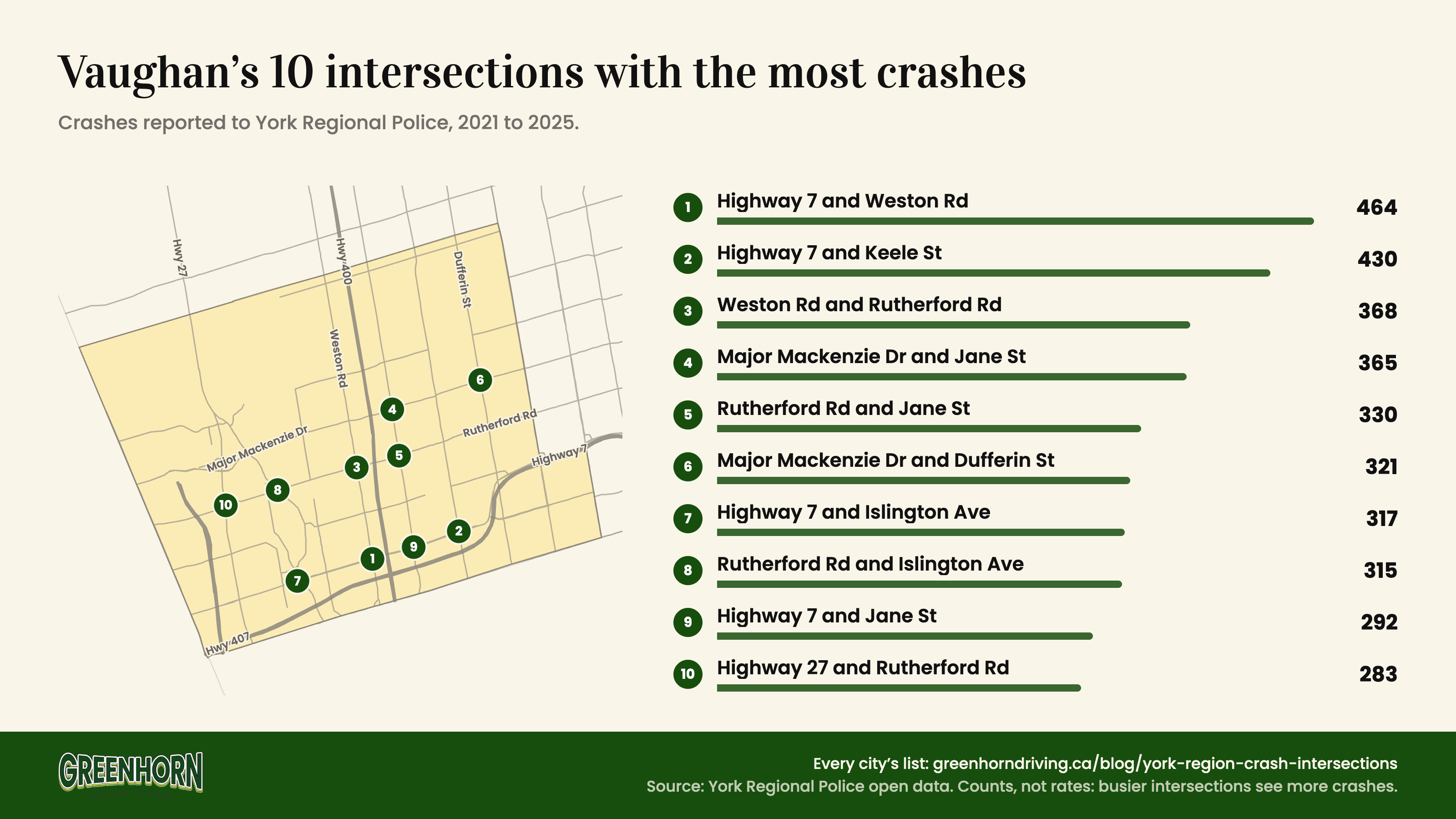
Yonge Street and Green Lane in East Gwillimbury, just north of Newmarket, had more crashes reported to York Regional Police than any other intersection in York Region from 2021 to 2025: 484, nearly two a week, and 66 more so far in 2026. Highway 7 and Weston Road in Vaughan (464) and Highway 7 and McCowan Road in Markham (451) came next.
City by city, the top spots were Yonge and 16th Avenue in Richmond Hill, Highway 7 and Weston in Vaughan, Highway 7 and McCowan in Markham, Yonge and Wellington in Aurora, Yonge and Davis in Newmarket, and Dufferin and Centre in Thornhill. Five of the six were in York Region’s own city top tens the last time it ranked intersections, in 2022.
The data also shows when crashes happen. Every one of the 25 worst days for crashes since 2021 had snow, that day or the day before, and crashes involving a pedestrian jump every fall: October or November was the worst month for them in every year.
These are counts of crashes reported to police, not risk rates. The busiest intersections carry the most cars, so they tend to top lists like this one. What the counts do show is where crashes keep happening, and when. How we counted is at the end.
The Top 10 in Each City
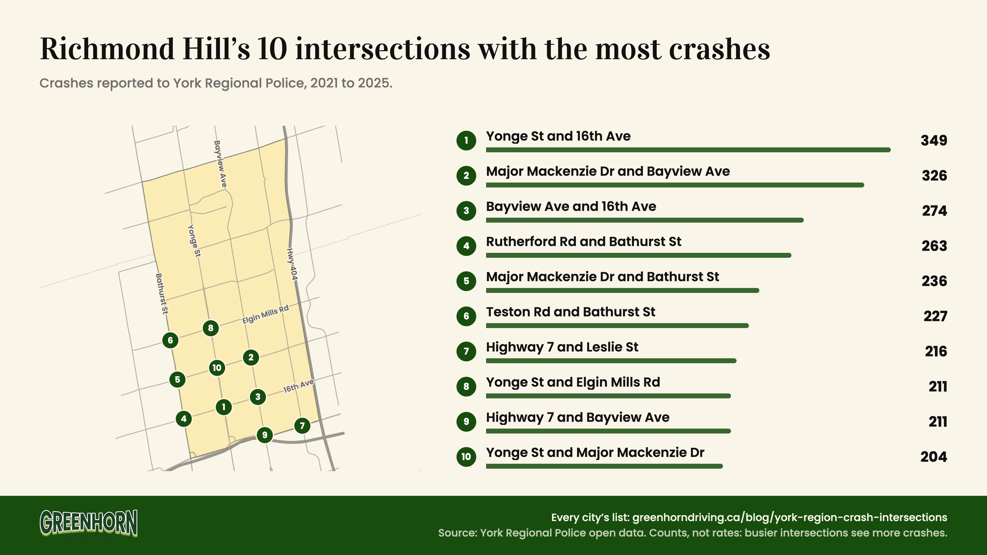
Pick a city to see its ten intersections with the most crashes reported to police from 2021 to 2025, and how many each has had so far in 2026. Intersections on a city line count for both cities.
| # | Intersection | Crashes | |||
|---|---|---|---|---|---|
| 1 | Yonge St and 16th AveIncludes Yonge St and Carrville Rd | 349 | 38 | 65 | 56 |
| 2 | Major Mackenzie Dr and Bayview Ave | 326 | 30 | 62 | 49 |
| 3 | Bayview Ave and 16th Ave | 274 | 22 | 45 | 40 |
| 4 | Rutherford Rd and Bathurst StOn the Vaughan line | 263 | 20 | 45 | 46 |
| 5 | Major Mackenzie Dr and Bathurst StOn the Vaughan line | 236 | 29 | 43 | 38 |
| 6 | Teston Rd and Bathurst StOn the Vaughan line | 227 | 24 | 41 | 31 |
| 7 | Highway 7 and Leslie StOn the Markham line | 216 | 18 | 50 | 43 |
| 8 | Yonge St and Elgin Mills Rd | 211 | 28 | 40 | 27 |
| 9 | Highway 7 and Bayview Ave | 211 | 24 | 45 | 28 |
| 10 | Yonge St and Major Mackenzie Dr | 204 | 15 | 54 | 45 |
Crashes and with injury: 2021 to 2025. 2026 so far: January 1 to October 28.
Highway 7 Holds the List
11 of the 25 intersections with the most crashes in York Region are on Highway 7, including all five of Markham’s top five and four of Vaughan’s top ten. It is the main east-west road through York Region’s two biggest cities.
The list barely moves. In its 2022 Traveller Safety Report, York Region ranked its own top five for 2019 to 2021: Islington Ave and Rutherford Rd, Keele St and Highway 7, Highway 7 and Weston Rd, Yonge St and Green Lane, and Highway 7 and McCowan Rd. Four of those five are in our top four now. The top spot is the same as in that report in Richmond Hill, Markham and Aurora.
How to Drive Each City’s Top Intersection
What the numbers say about each one, and what our instructors tell students who drive them.
Richmond Hill: Yonge Street and 16th Avenue
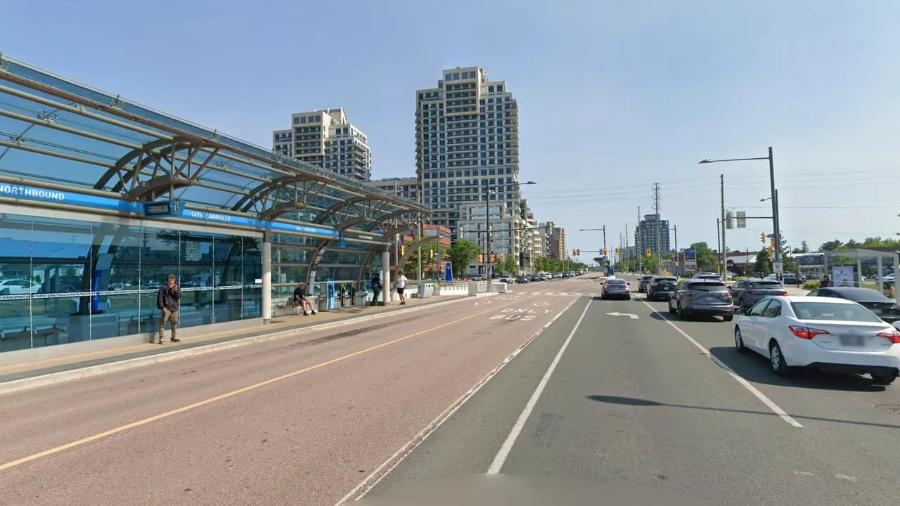
349 crashes, just ahead of Major Mackenzie Dr and Bayview Ave (326). West of Yonge the road becomes Carrville Road, and since 2020 Viva buses have run in a rapidway down the middle of Yonge, with the 16th-Carrville station in the median. York Region ranked it the worst intersection in the region for crashes involving pedestrians over 2012 to 2021, and 9 of the 36 injury crashes on its file here involved someone on foot.
How to drive it: Bus riders cross to and from the station in the middle of the road, so expect people in the crosswalks on every light change, especially when you turn. Rear-ends are the most common injury crash here (12 of 36), so leave a gap you could stop in if the car ahead brakes for someone in the crosswalk.
Vaughan: Highway 7 and Weston Road
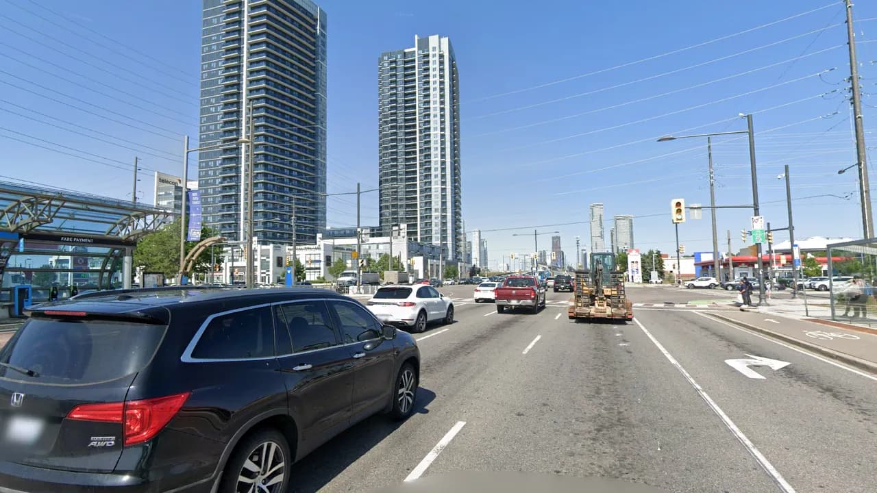
464 crashes, just ahead of Highway 7 and Keele St (430). Plazas line the corners, the Colossus Centre sits just to the south-east, and the Highway 400 ramps start about half a kilometre east. A Viva rapidway runs down the middle of Highway 7 with a station at Weston, and this is the only one of the six top spots with a red light camera.
How to drive it: Rear-ends (15 of 45 injury crashes on file) and turning crashes (12) lead here. On the Highway 7 rapidway, York Region allows left turns and U-turns only on the left-turn signal, so wait for the arrow rather than looking for a gap, and expect the car ahead to stop on a stale yellow with a camera watching.
Markham: Highway 7 and McCowan Road
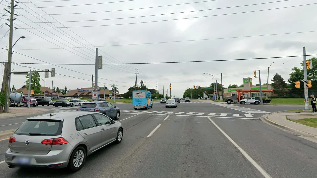
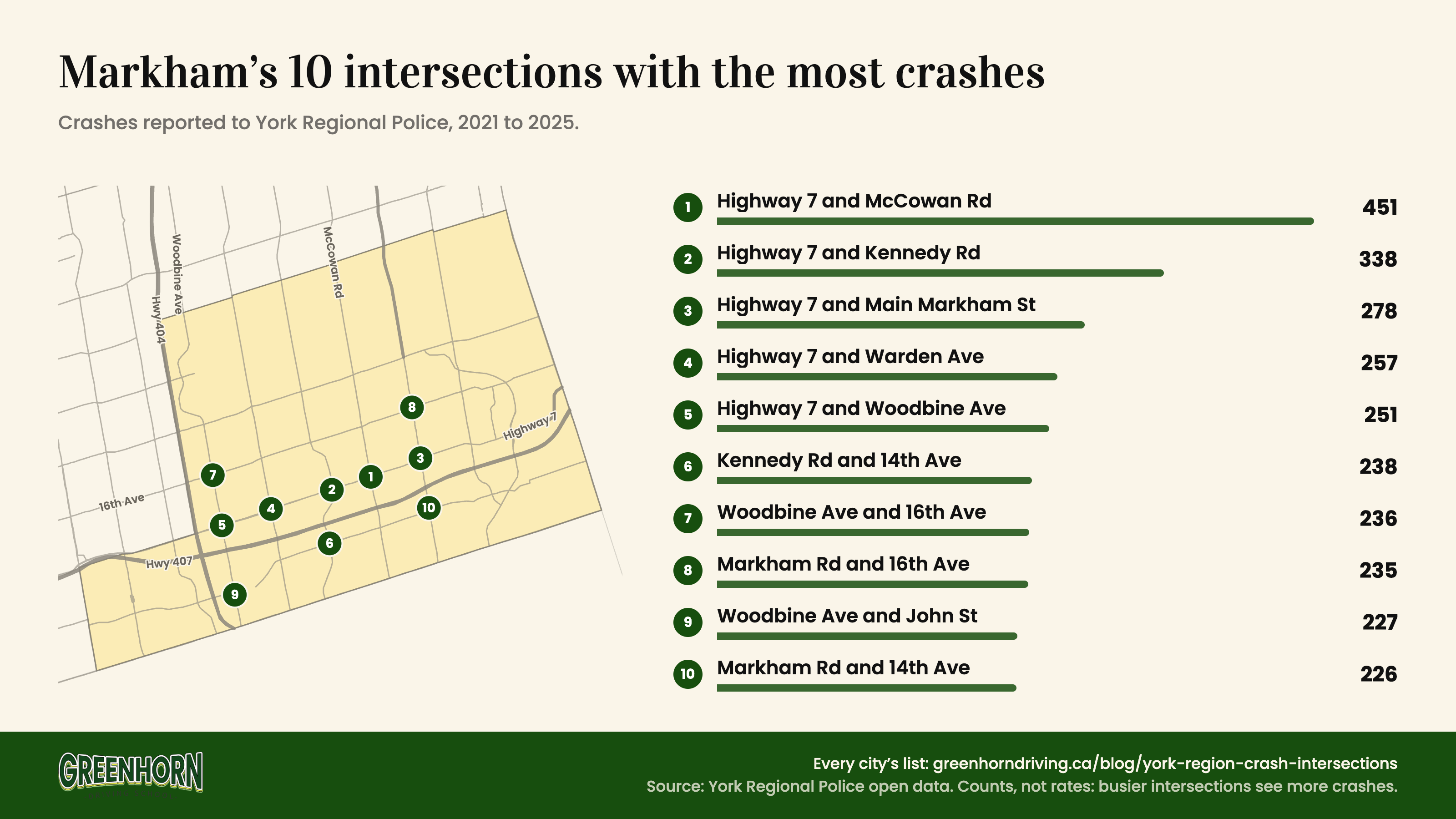
451 crashes, 33% more than Highway 7 and Kennedy Rd in second, the clearest lead in any city. There is no rapidway on this stretch: Viva buses run in regular traffic and stop at the curb just past the intersection. CF Markville is a few hundred metres to the north-west, and the Highway 407 ramps are about a kilometre south on McCowan. Of the 45 injury crashes on York Region’s file here, 7 involved a pedestrian and 5 a cyclist.
How to drive it: York Region has banned right turns on red here as part of its Vision Zero work, so read the signs and wait for the green even when the road looks clear. When you do turn right, check the crosswalk and the curb lane for a bike first, and leave room for a bus pulling away from the stop ahead of you.
Aurora: Yonge Street and Wellington Street
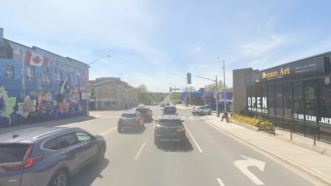
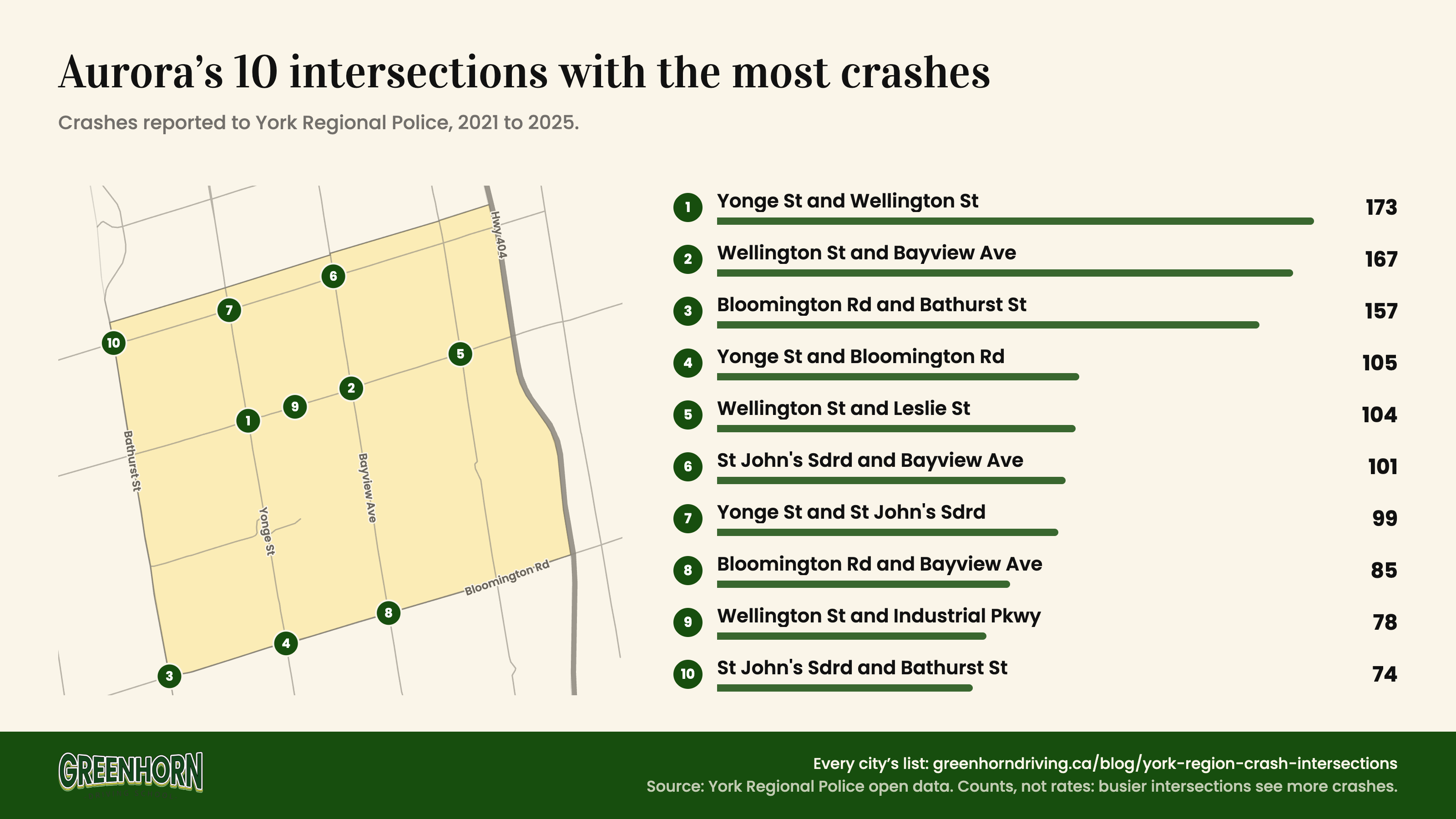
173 crashes, just ahead of Wellington St and Bayview Ave (167). This is the centre of old Aurora, a main-street corner with shops, a bank and restaurants on its corners, and Wellington Street East is a community safety zone, where fines are higher. 82% of crashes here came on weekdays, and the busiest hour was 8 am. Of the 12 injury crashes on York Region’s file, 5 involved someone on foot.
How to drive it: With people stepping off the curb on every corner, check the crosswalk you are turning into twice, once as you slow and again just before you go. Heading north, the Viva stop is just past the intersection on the right, so leave room in case the bus ahead pulls in.
Newmarket: Yonge Street and Davis Drive
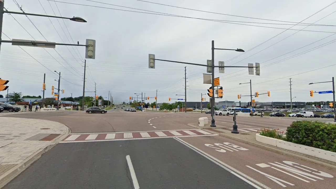
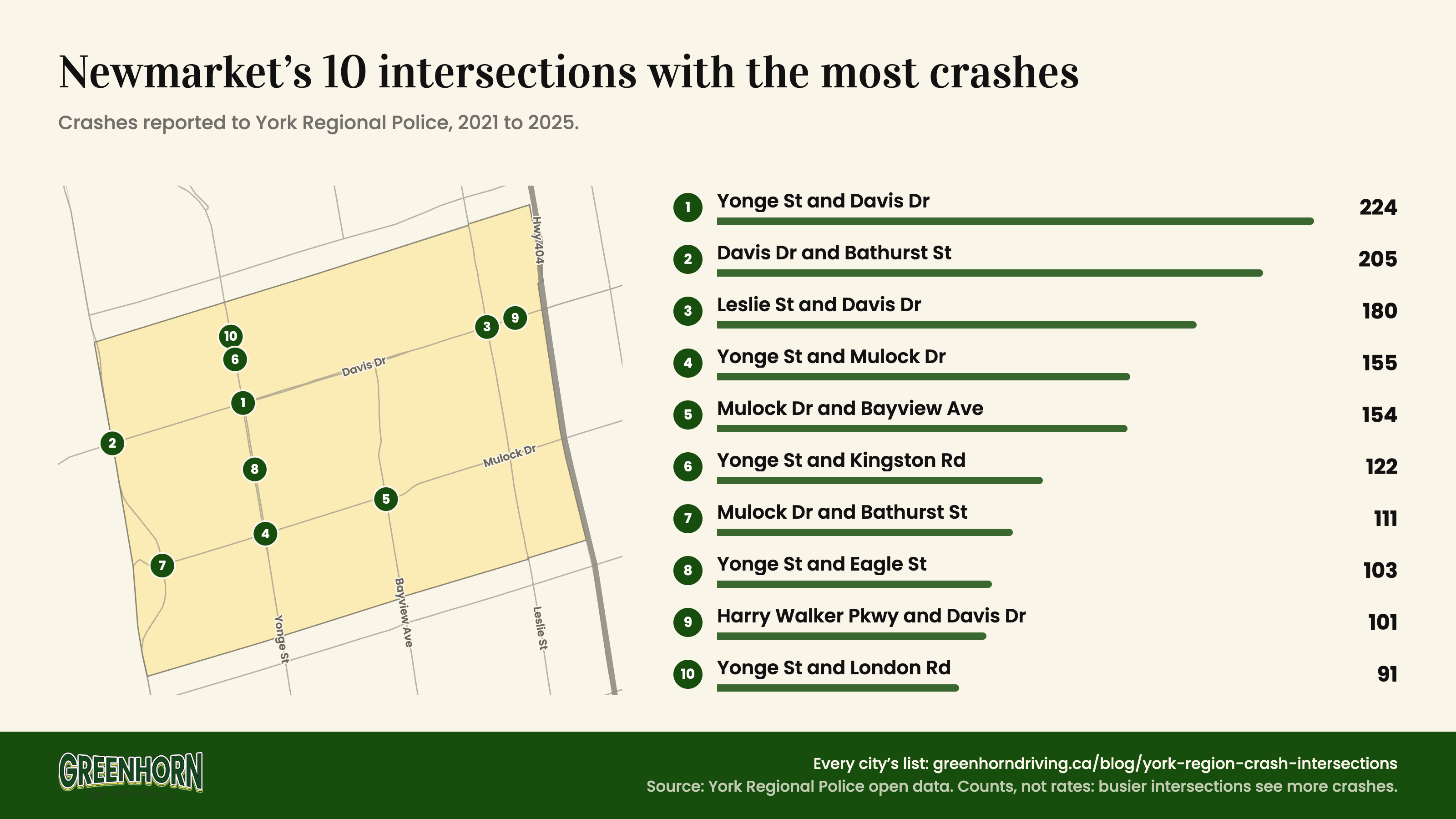
224 crashes, just ahead of Davis Dr and Bathurst St (205). Two Viva rapidways meet here, on Yonge to the south and Davis to the east, with plazas on three corners and Upper Canada Mall a short way north-west. Saturday had more crashes than any other day. North of Davis, Yonge is under construction until late 2027 while York Region widens it to six lanes.
How to drive it: More than half the injury crashes on file here are rear-ends (17 of 29). On the rapidway legs, York Region allows left turns and U-turns only on the left-turn signal, so the car ahead may stop and wait for the arrow when you expect it to go. Keep at least two seconds behind it, more in the construction zone.
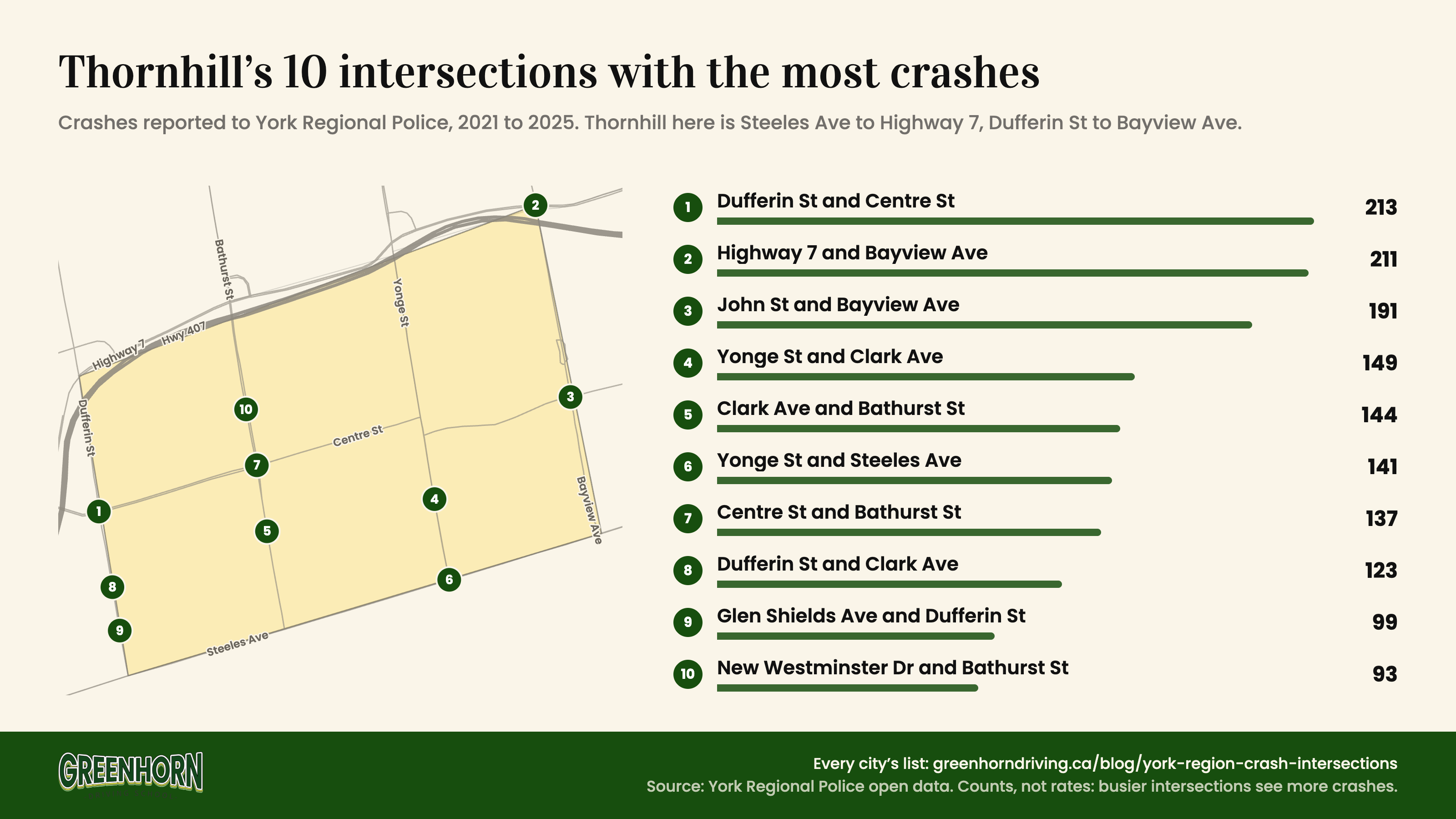
Thornhill: Dufferin Street and Centre Street
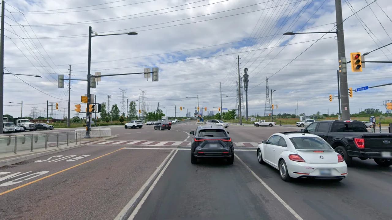
213 crashes, just ahead of Highway 7 and Bayview Ave (211). Centre Street carries a Viva rapidway with a Dufferin station in the median, and Highway 407 runs about 450 m to the west. 86% of the crashes here came on weekdays. It was also on York Region’s list of the ten worst intersections for cyclist crashes over 2012 to 2021.
How to drive it: Rear-ends lead the injury crashes on file (11 of 24), and 4 involved a cyclist. Before you turn right, check your mirror and look over your shoulder for a bike coming up on your right, then for people in the crosswalk.
When Crashes Happen
Weekday afternoons have the most crashes. Fridays had the most crashes in all five cities, and the 5 pm hour was the worst in Richmond Hill, Vaughan and Markham.
Snow Days
Every one of the 25 days with the most crashes since the start of 2021 had snow, that day or the day before, at Environment Canada’s Pearson station. The worst was Friday, March 22, 2024: 260 crashes, more than four times a normal Friday around then, on a day with 11.6 cm of snow. Across all days with 5 to 10 cm, crashes ran about 1.6 times a normal day.
Pedestrians in the Fall
Crashes involving a pedestrian rise every fall. November had 255 over the five years, more than twice April’s 120, and November came in 1.4 to 2.8 times the spring months in every one of those years. York Region’s own injury records show the same rise.
Crashes involving a pedestrian, by month
All of York Region, 2021 to 2025 combined. October to December in green.
| January | 143 |
|---|---|
| February | 129 |
| March | 144 |
| April | 120 |
| May | 145 |
| June | 144 |
| July | 129 |
| August | 136 |
| September | 184 |
| October | 228 |
| November | 255 |
| December | 194 |
The 5 pm hour shows it most: 34 pedestrian crashes in that hour across five Novembers, against 6 to 9 in each month from April to August. After the clocks go back, the drive home happens around sunset or after it. 89% of these crashes hurt the person on foot.
Not all of them happen on the road. 469 of the 1,951 crashes involving a pedestrian were in parking lots, nearly one in four, and so were 23,791 of all 102,501 crashes. No intersection list counts them.
Drive These Intersections With an Instructor First
Our private lessons run across Richmond Hill, Vaughan, Markham, Aurora, Newmarket and Thornhill, on the roads you will actually use, including the ones on this list.
Book a Private Lesson
How We Counted
- Crash counts come from York Regional Police’s Community Safety Data Portal, January 1, 2021 to December 31, 2025, pulled October 29, 2026. They include crashes drivers reported themselves at a collision reporting centre, not only the ones police attended. YRP updates the data daily, so counts can shift slightly.
- One crash is one police case. YRP lists a crash and any charge laid with it as separate records, so we counted cases, not records. That gives 102,501 crashes across the region in five years, 12,639 of them with an injury.
- YRP moves every crash to the nearest intersection to protect privacy, so a crash a short way from an intersection counts toward it. Crashes in parking lots (23,791) have no intersection and are not in the rankings. Crashes on Highways 400, 404, 407 and 427 are handled by the OPP and are not in the data.
- Where a cross street changes name at the intersection (16th Avenue becomes Carrville Road at Yonge), we merged the names. An intersection on a city line counts for both cities.
- Thornhill is split between Vaughan and Markham and has no official boundary, so we used Steeles Avenue to Highway 7 and Dufferin Street to Bayview Avenue, roads on the edge included.
- These are counts, not rates. York Region does not publish traffic volumes for its intersections, so we cannot say which is riskiest per car. Year-to-year totals are not compared either: the share of crashes reported by drivers themselves changed a lot over the five years.
- Injury crash types at each top intersection come from York Region’s injury collision records for Regional roads, which go back to 2017 with some gaps. Snow is Environment Canada’s daily record at Toronto Pearson; a normal day is the same weekday in the weeks around it with no snow or rain.
- Reporters and editors are welcome to use these numbers and our top 10 graphic for each city (Richmond Hill, Vaughan, Markham, Aurora, Newmarket and Thornhill) with credit and a link to this page. Each city’s list has its own address, for example #top-10-newmarket. Questions go to [email protected].
Common Questions About York Region’s Crash Intersections
By crashes reported to York Regional Police from 2021 to 2025, the top intersection was Yonge Street and Green Lane in East Gwillimbury, just north of Newmarket (484), then Highway 7 and Weston Road in Vaughan (464) and Highway 7 and McCowan Road in Markham (451). These are counts, not risk rates: the busiest intersections carry the most traffic.
Yonge Street and 16th Avenue (Carrville Road on the west side) had the most crashes reported to police from 2021 to 2025, 349, followed by Major Mackenzie Drive and Bayview Avenue (326).
Highway 7 and Weston Road had the most crashes reported to police from 2021 to 2025, 464, followed by Highway 7 and Keele Street (430).
Highway 7 and McCowan Road had the most crashes reported to police from 2021 to 2025, 451, well ahead of Highway 7 and Kennedy Road (338). All five of Markham’s top five are on Highway 7.
On weekday afternoons, Fridays most of all, and on snow days. Every one of the 25 days with the most crashes since 2021 had snow. Crashes involving pedestrians peak in November, when the drive home happens around sunset or after it.
More for York Region drivers


Sources: York Regional Police, Community Safety Data Portal (road safety data, 2021 to 2025), York Region, 2022 Traveller Safety Report, Environment Canada historical climate data. Maps and injury crash types contain public sector information made available under The Regional Municipality of York’s Open Data Licence.